Home » Vulnerability Assessments & Peril of Flood Compliance Recommendations
This report is composed in partial support of the Department of Economic Opportunity’s Technical Assistance Grant P0317. This grant was designed to provide funding to allow the South Florida Regional Planning Council (SFRPC) to assist the Town of Lauderdale-By-The-Sea, City of Marathon, and Islamorada, Village of Islands, with updating their comprehensive plans to identify and address any deficiencies within these plans following the Peril of Flood Amendment, Section 163.3178(2)(f) in the Florida Statutes. This report provides a vulnerability assessment to identify the coastal areas within each municipality and to understand the risks that result from high tide events, storm surge, flash floods, storm water runoff, and other impacts that could develop because of rising sea level.
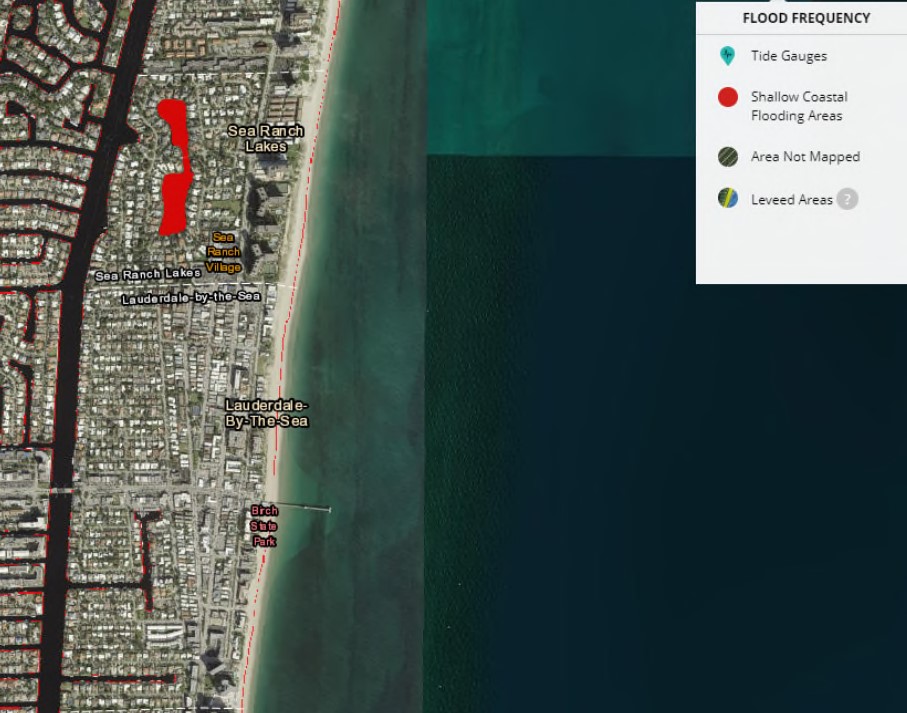
This report contains maps representing 1- and 2- feet of sea level rise as predicted for the South Florida region to occur by 2040 and 2060 respectively. Sea level rise is not the only concern for the region, as coastal storms are occurring more regularly. The Coastal High Hazard Area (CHHA) is defined by the Florida Statutes as the area of land that is located below the elevation of a Category 1 storm surge line by the Sea, Lake, and Overland Surges from Hurricanes (SLOSH) models.
The City of Dania Beach and the Village of Palmetto Bay are coastal municipalities in South Florida. Both are affected and threatened by a rising sea level and the increased floods that will result from this change. The City and Village have created plans and instituted policies to protect and enhance their communities from the challenges posed by increased flooding. Using this Report as summary and focal point, the South Florida Regional Planning Council will continue to assist Dania Beach and Palmetto Bay in updating their respective Comprehensive Plans to include additional language to fully address the objectives of the Florida Statute known as Peril of Flood.
This report provides comprehensive plan updates for review, in a strikeout and underline format. The proposed Plan amendments include goals, objectives, and policies that satisfy the “peril of flood” requirements in Section 163.3178(2)(f), Florida Statutes, and any new policy direction that the Municipal representatives vote to include. The description of the deliverable is as follows: “Review of existing Coastal Management element and suggested Goals, Policies, and Objectives to bring the element into compliance with Peril of Flood legislation.”
Through funding from the National Oceanographic and Atmospheric Administration (NOAA) and the Florida Department of Environmental Protection (DEP), DEO worked with the South Florida Regional Planning Council (SFRPC) and Florida’s nine other Regional Planning Councils to create regional Vulnerability Assessments and conduct a series of trainings which allowed for:
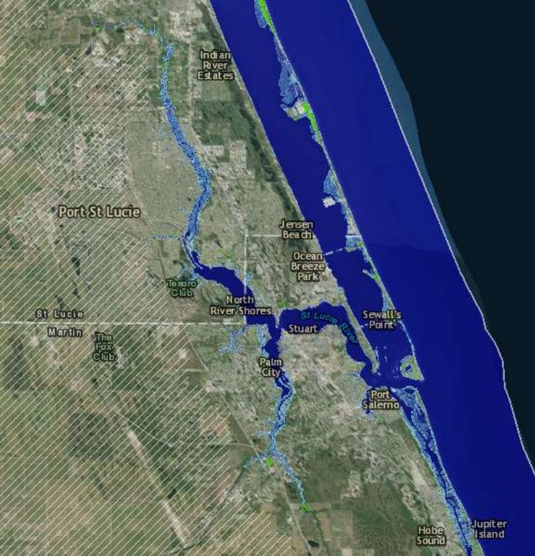
This Sea Level Rise Vulnerability Assessment of Evacuation Routes in Martin and St. Lucie Counties explores future sea level rise risks with a focus on transportation and evacuation in a defined coastal study area within Martin and St. Lucie Counties. Using the GeoPlan Sketch Tool, this vulnerability assessment evaluates the influence of sea level rise (SLR) projections on the future of emergency preparedness planning. It specifically shows the projected inundation of county designated coastal evacuation routes and how future SLR will affect the ability of coastal communities to safely evacuate from man-made or natural disasters. Using the tools described in this report to assess evacuation planning methods are a critical component of addressing coastal vulnerabilities and mitigating losses. The results inform adaptation planning for the study area and provide an example for applications statewide.